Day Two: Falls Creek/8 Mile Ridge and a world of hurt
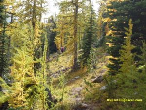
Two years ago Team Mojo scaled Falls Creek, only to encounter a passel of hassle. It’s not a bad trail, particularly the first four miles or so. There are some creek crossings, yes. The trail gets sketchy here and there, yes. But it’s beautiful country, no one’s around and the terrain is challenging, varied and rapturous.
Still, we eventually had to call it quits. After emptying out into a broad meadow sliced by a babbling creek, we simply could not find the trail. When you ride with Jim the Lyon King, that’s saying something. A onetime professional mountain guide, Jim can point out trails on ridges miles away that look like nothing more than seas of trees. After spending nearly half an hour wandering around, Jim finally picked up a scent. There it was — a rocky, eroded line of rubble climbing straight up the hillside. It didn’t look like much fun, and the sun had disappeared behind the ridge. We decided to leave it for another day.
Fast forward to our Winthrop weekend of 2010, and there we were again, this time armed with two data points: 1. We knew where the disappearing trail picked back up again. 2. Joe had told us that the horsers had done some maintenance up there.
To get to Falls Creek you drive up West Chewuch Road), past Road 5130 on your left, taking Road 5140 on the left. It climbs for a long time, but get this: It’s all paved! We’ve run into this from time to time, typically on logging roads that also serve as fire-access roads. It’s pretty nice; you can make twice the time as the typical rutted, water-bar-laden fire road. Eventually the road dead ends right at the head of Trail 518, and you’re in business.
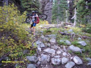
We got an earlier start and made great time to the point where the trail steepens. After that it was a matter of grunting, pushing, cursing and carrying — but all with the knowledge that we weren’t that far from the 8 Mile Ridge line — and from there it had to be all downhill.
There had been some maintenance, yes. But the trail wasn’t any great shakes. A lot of loose rock, and solid rock, and big rock.
Finally we topped out at Burch Mountain and took a few moments to look around. You’re at 7,400 feet at that point and the world looks pretty reasonable. This time, I felt sure I wasn’t going to get any phone calls.
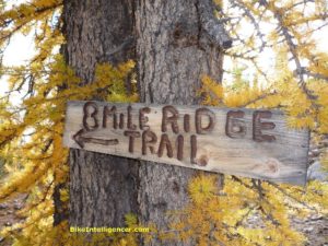
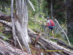
There’s a nice big fat sign at the trail top reading “Eight Mile Creek” and sitting abreast what looks to be the start of a nice downhill run. And for a few hundred yards, it was. Then it got a little thin. Then we ran into a couple of blocking blowdowns. Then a couple more. After half a mile there was hardly any indication of a trail, logs lay strewn about like matchsticks, we’d descended more than 500 feet and it was time to reconnoiter.
But dude! We’d climbed nearly 5,000 feet! We deserved this downhill! We’d earned our verts!
“Actually, we may have to climb another ridge,” Jim said. “That is, if we can keep track of the trail at all.”
I’ve never been much for common sense, else I’d probably have given up on mountain biking a long time ago. But this time the handwriting was not just on the wall. It was on the trail, the bikes, the ridge and all over the sky. We literally did not have any choice.
We trudged back up the ridge — this is called blowing your verts — and, once at the top, started the ride back down. It wasn’t going to be a great ride, at least till it leveled out at the meadow below. But at least we knew we could get back to the car.
As I said, we were basically riding rock. I love this kind of stuff, challenging and absorbing, and took off down the ridge with whoops and hollers. Jim yelled something after me that I couldn’t hear, I was having too much fun.
Unfortunately, I soon got a bit ahead of myself. I was JRA, Just Riding (more like bouncing) Along, when something happened and I went over the bars in a big hurry. I slammed my left side into solid granite and felt my arm buckle under me. I sat there in a yard-sale heap for a few moments, tangled up with my Mojo. Then I started to move, hoping nothing would signal broken bones.
The worst off was my elbow. Already a big lump had formed at the crook of my arm. My forearm had a long stretch of raw skin beginning to bleed. I felt short-winded and nauseous. But my arm seemed to work OK.
It seemed like an eternity before Jim — who was wisely walking his way down — caught up with me. His first words: “Didn’t I tell you?”
“Tell me what?”
“Right before you rode off. I said, ‘Discretion is the better part of valor’.”
What the? What was this, the mountain bike Quote of the Day? And anyway, I hadn’t heard him.
Admittedly, Jim had been right. “Um…uh,” I mumbled. “What do you think? Is my arm OK?”
Jim had me do some rotation and clenching motions. Everything seemed to work. I slapped some Neosporin on my forearm and we were good to go. I felt pretty washed out — shock will do that to you — and from that point on took it a bit easier. Please don’t tell my wife about this, as she never reads this blog.
After the trail leveled out it was pretty much a scream back to the car. I couldn’t fully enjoy it — something was catching at my left rear rib cage and Jim speculated I’d pulled or torn one of the little connector muscles. But given what might have been, I felt happy to be upright and rotational.
The ride nonetheless felt like half a loaf. We’d dealt with the unfinished business of two years earlier, to the extent that we made it to the top of the ridge. But we felt woefully cheated out of a killer ride down 8 Mile Ridge. Mayhap the horsers or Methow Valley Sport Trails Association (MVSTA) will find the wherewithal to clear 8 Mile Ridge and we’ll get to complete the job some day.
Back in Seattle, we ran into Peter Morgan, acting executive director of the Cascade Bicycle Club. Peter mentioned he’s proprietor of the Methow Valley Inn and invited us back for a stay. We’ll be sure to check it out the next time we go riding in Winthrop. After all, we still have that unfinished business calling out our name.
[Mileage: 12.2 / Elevation gain: 3,236 feet / Maximum grade: 16 percent / Time: 4 hrs 39 mins. The Falls Creek/8 Mile Ridge trails are tricky to track on Green Trails. You’ll need Map Nos. 52 (to show access roads), 51 and 19.]]

You were so close, after the “matchsticks” you can continue on with the ridge to your right and eventually you’ll cross the trail and it gets better and better all the way down. You did the hard part—next time!